
Echoes Along the Rambla de Nogalte
In southwestern Murcia, the landscape explains much of the history. Dry riverbeds cut through a sunlit, semi-arid terrain, creating natural corridors between Andalusia and the Mediterranean Levant. The Rambla de Nogalte and the wider Guadalentín Valley were not merely geographical features. They were routes for movement, water, trade, livestock, armies, and information. Whoever could observe and control these passages held an important advantage.
Between the thirteenth and fifteenth centuries, Puerto Lumbreras occupied a porous but dangerous frontier zone. The border between Christian Murcia and the Muslim Kingdom of Granada was never simply a line on a map. It was a shifting belt of fortified settlements, rural farms, watchtowers, truces, raids, and seasonal movement. Above this unsettled world stood Castillo de Nogalte, watching over the valley and the communities that depended on it. Its importance lay not only in its walls, but in the daily resilience of the people who lived, farmed, traded, and prepared for danger beneath them.
Guardians of the Pass at the Andalusian Gateway
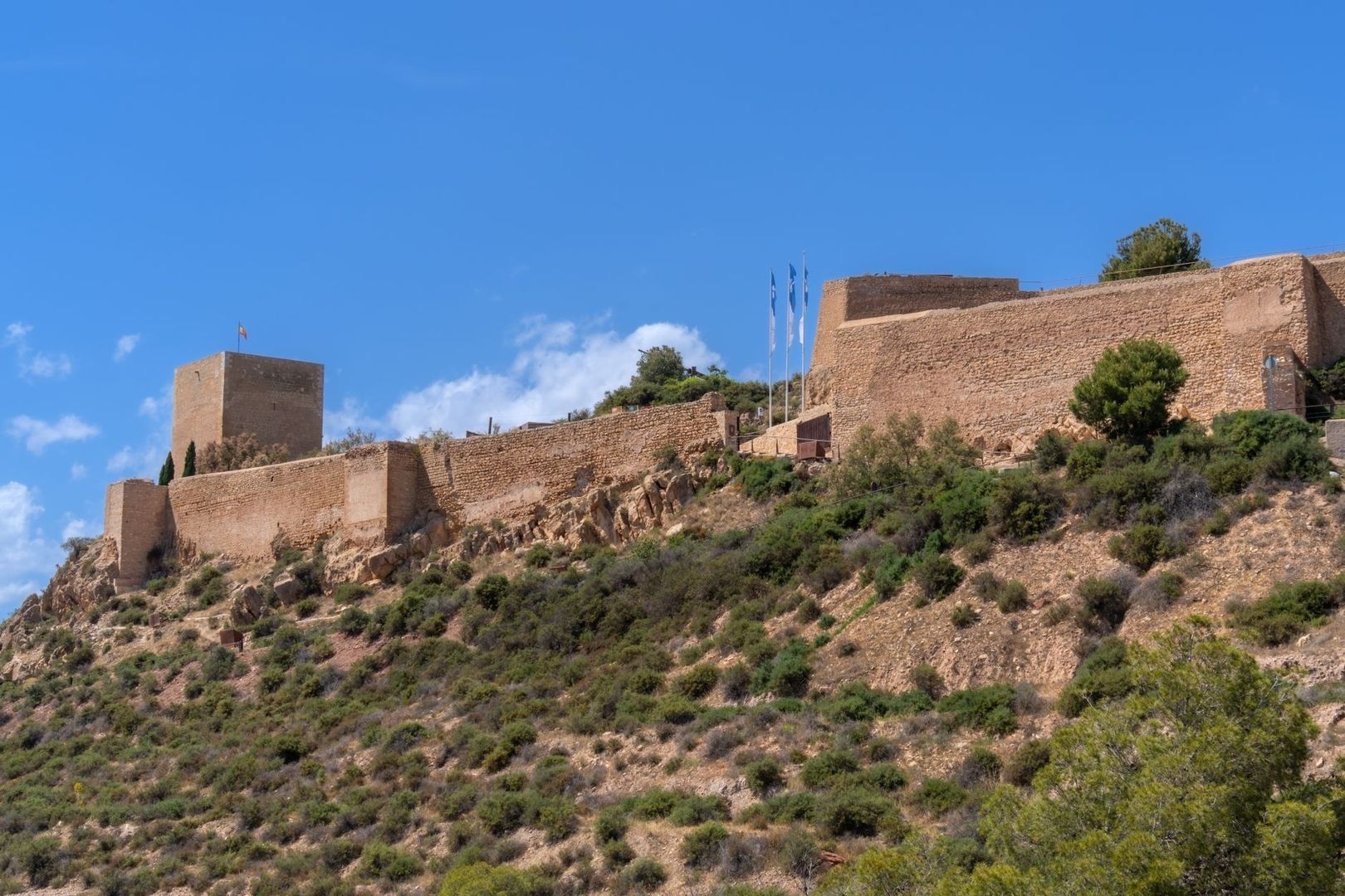
Castillo de Nogalte was an Islamic hisn, a fortified site that combined military, administrative, and economic functions. Built between the twelfth and thirteenth centuries on Cerro del Castillejo, it occupied a commanding spur above the Rambla de Nogalte and close to the Sierra de Enmedio. From this position, defenders could oversee natural routes toward Lorca and Murcia, as well as passages leading toward Granada and Almería. The location was carefully chosen: it offered visibility, controlled access to water, and provided protection for scattered rural farmsteads.
The fortress was part of a wider settlement system rather than an isolated military outpost. A small permanent garrison carried out defensive duties while also participating in agriculture and livestock raising. The site”s cisterns, storage areas, millstones, ceramics, and other archaeological remains point to a community concerned with preserving food and water as much as with resisting attack. In a dry environment, control of springs and storage capacity could determine whether a settlement endured a difficult season or survived a period of insecurity.
Its structure also records the political changes of the frontier. Excavations have identified two interconnected enclosures built largely with rammed earth. The upper enclosure probably belonged to the Islamic phase and may have functioned as a fortified granary during an especially uncertain period. Following the Christian conquest, the lower enclosure was added and parts of the upper area were modified. Construction features associated with standards used under Alfonso X in 1261 help place these alterations within the changing Castilian administration of the region. Archaeological records document this evolution, and the site is cross-referenced in modern heritage resources such as the regional historical inventory.
- The upper enclosure contained storage spaces, millstones, and a substantial cistern.
- The lower enclosure included rectangular rooms, a tower, strengthened walls, and a more complex protected connection.
- A characteristic Andalusi entrance, incorporating three arches and changes of direction, made direct access difficult.
- The fortress formed a secondary defensive line behind larger strongholds such as Los Vélez and Xiquena, while working with Tirieza to protect the frontier of Granada.
The political framework changed after Castilian expansion into southeastern Iberia. The Treaty of Alcaraz and later thirteenth-century arrangements placed Murcia within the Castilian sphere, while subsequent border demarcations defined a contested boundary with Granada. Muslim inhabitants abandoned Nogalte for Granada, and the castle was later granted to the council of Lorca after an Aragonese incursion. The transformation was therefore gradual and complicated, involving conquest, migration, reassignment, and reuse. Puerto Lumbreras itself did not develop a permanent population settlement until the seventeenth century, but the strategic importance of the site continued to shape the area long before then.
Smoke, Mirrors, and the Frontier Early Warning Network
A medieval fortress did not defend a valley alone. Its effectiveness depended on communication with other fortified places. Nogalte maintained visual contact with nearby towers and formed part of a chain that connected the local corridor with larger defensive centres, including Lorca Castle. Across the Guadalentín, elevated positions allowed observers to identify movement at a distance and pass warnings from one strongpoint to another. The system relied on geography, discipline, and shared expectations about what different signals meant.
In daylight, smoke, flags, reflective surfaces, or visible movement could communicate an alarm from one lookout to the next. At night, fire was more useful, although darkness, wind, distance, and false signals created obvious risks. A small tower did not need to defeat a large force by itself. Its purpose was often to detect danger early, delay access, protect people and supplies, and alert the larger garrisons that could organise a stronger response. Recent comparative archaeological research, including the study available through frontier fortification studies, demonstrates how terrain, sightlines, and the changing internal use of castles are essential to understanding Iberian defence.
The frontier network combined major enclaves with smaller sites arranged in depth. Political authority also mattered. In the Murcian sector, military organisation was linked first to the adelantado mayor and later, after the Aragonese intervention of 1296, to the procurador, who held military and judicial responsibilities. Treaties and truces were as important as masonry. Agreements could reduce raids and stabilise the border, but the very existence of the watch system reflected the knowledge that political conditions could change quickly.
| Defensive moment | Typical method | Purpose |
|---|---|---|
| Daylight observation | Lookouts monitored roads, valley approaches, water sources, and unusual movement. | Detect travellers, livestock raids, armed groups, or approaching forces as early as possible. |
| Daylight communication | Visible signals such as smoke, flags, or other agreed gestures could pass an alert between elevated sites. | Extend the warning beyond the immediate horizon and bring larger fortresses into readiness. |
| Night watch | Fires and close observation replaced many daylight signals, with guards relying on known silhouettes and controlled access. | Protect entrances, discourage surprise attacks, and maintain contact when visibility was limited. |
| Alarm response | Garrisons secured gates, protected stored grain and water, and warned nearby rural households. | Preserve the settlement”s resources while military authorities assessed the scale of the threat. |
These routines were practical rather than theatrical. A warning only had value if people knew what to do with it. The defenders of Nogalte had to distinguish ordinary pastoral movement from suspicious activity, understand which routes were vulnerable, and coordinate with nearby settlements. The fortress therefore functioned as a point in a living communications landscape, linking walls, roads, farms, towers, and the wider political authorities of the frontier.
Everyday Life in the Shadow of the Watchtower
Frontier life was shaped by environmental pressure as much as by military danger. The Rambla de Nogalte was often dry, yet sudden rainfall could produce destructive flash floods. Families farming near its course had to make practical decisions about where to build, how to guide water, and when to move animals or supplies. On the surrounding slopes and terraces, cultivation depended on careful water management. Springs, cisterns, channels, and storage areas were essential forms of security, and the castle”s oversight of these resources gave its garrison a direct role in the survival of nearby communities.
Farming did not stop because the border was unstable. Rural households continued to grow crops, tend animals, repair terraces, and exchange goods. Pastoral transhumance brought seasonal movement across the region, while trade connected local producers with settlements farther along the valley. The same routes that supported commerce could also be used by raiders or military forces. This created a precarious coexistence in which openness was economically necessary, but vigilance was equally necessary.
Long periods might pass without a major attack, yet readiness could not be abandoned. Households likely relied on habits that reduced risk: keeping food in reserve, storing water, observing the hills, maintaining links with neighbours, and knowing where to seek protection. The castle”s enclosures provided a place for supplies and defence, but security also depended on the surrounding population. A rural community that could alert others quickly, move animals, and preserve grain was more resilient than one that relied only on the walls of a single fortress.
- Water was collected, protected, and stored because dry conditions made springs and cisterns strategic resources.
- Food storage helped rural households withstand disrupted harvests, raids, or periods when movement was unsafe.
- Livestock required flexible management, especially when seasonal grazing routes crossed exposed areas.
- Local knowledge of ravines, slopes, tracks, and elevated viewpoints was an important part of frontier security.
- Trade and neighbourly cooperation continued despite the possibility of sudden violence.
This combination of danger and routine shaped the social character of the area. The frontier was not permanently at war, but neither was it secure in the modern sense. People learned to balance cultivation with caution, mobility with shelter, and commercial contact with the possibility of interruption. That practical adaptability is one reason Castillo de Nogalte should be understood as the centre of an integrated landscape, not simply as a ruin on a hill.
From Medieval Fortress to the Cave Houses of Today
Centuries after the medieval military system had faded, Nogalte Hill acquired a different form of habitation. From the eighteenth century onward, cave houses were carved into the sandstone slopes near the castle. These homes responded to local materials and climate, offering thick earthen walls, moderated interior temperatures, and a distinctive way of adapting domestic life to the terrain. The cave dwellings were not medieval military quarters, yet they continued a much older local tradition of making the landscape itself part of everyday security and shelter.
Today, the castle and cave houses are presented together through a cultural heritage route that interprets fortification, water management, crafts, domestic life, and local memory. The complex includes themed spaces dedicated to the medieval Islamic castle, cave traditions, artisan work, exhibitions, audiovisual material, educational activities, and a reconstructed mid-twentieth-century school. The municipality”s cultural heritage programme also places the site within a broader group of attractions, including museums, historic buildings, and local walking routes. Visitor conditions can change: the site is currently marked as temporarily closed, although guided visits are advertised by prior arrangement for groups of at least 15 people, while free unguided access may be available according to current arrangements. Check with the Puerto Lumbreras tourism office before travelling.
Musealisation gives the hill a civic meaning beyond military history. The fortification recalls political borders and organised defence, while the cave houses bring attention to families, work, water, crafts, and domestic continuity. Together they show how a community can inherit a difficult landscape without being defined only by conflict. Preservation allows visitors to see not just what was built to resist attack, but how people continued to make a home in the same terrain.
Walk the Frontier Paths of Puerto Lumbreras
The enduring impact of medieval strategy remains visible in Puerto Lumbreras. The castle”s position still explains the settlement”s relationship with the Rambla de Nogalte, the Guadalentín Valley, and the routes toward Murcia and Andalusia. The cave houses demonstrate how later generations adapted the hill for domestic use, while interpretation spaces connect archaeological evidence with the everyday work of farming, water management, schooling, and craft production. The result is a layered heritage landscape in which defence gradually gave way to residence, memory, and civic pride.
A visit is most rewarding when approached as a sequence rather than a single monument. The site”s access arrangements and opening conditions should be confirmed in advance, particularly because the heritage complex is currently marked temporarily closed and guided visits require prior booking. Once access is confirmed, allow time to observe the relationship between the fortress, the cave dwellings, the rambla, and the wider valley. The landscape is part of the evidence: slopes, sightlines, water routes, and distant elevations help explain why Nogalte mattered.
- Check current opening information and contact the Puerto Lumbreras tourism office before setting out.
- Begin with the castle remains and identify the two defensive enclosures, the entrance arrangement, storage areas, and cistern evidence.
- Follow the heritage route through the cave-house quarters and interpretation spaces, paying attention to water, crafts, schooling, and domestic life.
- Use the surrounding viewpoints and walking paths to imagine the medieval visual network linking Nogalte with other strongpoints in the Guadalentín corridor.
- Combine the visit with other local heritage attractions, allowing time for the town”s museums, historic buildings, and community traditions.
Castillo de Nogalte was never merely an isolated stone redoubt. It was the fulcrum of a system that watched routes, protected water, supported rural production, transmitted warnings, and helped communities endure uncertainty. Walking its paths today offers a quieter but no less meaningful encounter with that history. The walls may be fragmentary, but the landscape still preserves the logic of the frontier, while the cave houses and local cultural spaces reveal how necessity became belonging.